 GiftCoves
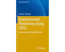
Earth and Environmental Science (R0) - Environmental Monitoring using GNSS
bij 1 winkel
Verwant
Streepjescode: 9783540882565

Alle aanbiedingen
- bol.comEarth and Environmental Science (R0) - Environmental Monitoring using GNSSNaar de winkel€ 155,00Op voorraad
We verdienen mogelijk commissie als je via deze link koopt. Wat jij betaalt verandert niet.
Over dit product
Global Navigation Satellite Systems (GNSS) are revolutionizing the world in a way their original developers never envisaged. From being military “war” tools, GNSS satellites are rapidly becoming “peace” tools that play a potentially critical role in enabling changing environmental phenomenon that do not permit direct measurements to be remotely observed via their all-weather, highly accurate and continuously updatable positional time series. This is evident, for example, in their use in emerging environmental monitoring methods that are considered in this book. These include: GPS-based radio telemetry, which is enhancing ecological and conservation monitoring by more accurately mapping animal movements, their behaviours, and their impact on the environment; GNSS-meteorology, which is contributing to weather and climate change studies; GNSS-remote sensing, which, for example, allows the rapid monitoring of changes in fresh water resources and cryosphere; Geosensor network techniques, which are earning a crucial role in disaster response management; Epidemiology, for improved efficiency in tracking and studying the spread of infectious diseases and climate change effects on vector-borne diseases; and Economics, to provide data for the econometric modelling of casual impact of policies. In Environmental Impact Assessments (EIA), Strategic Environmental Assessments (SEA), and Sustainability Assessments (SA), GNSS, together with other spaced-based remote sensing techniques, are emerging, not only as modern tools that connect the developers to the community, but also provide information that support Multi-Criteria Analysis (MCA) methods, which inform decision making and policy formulations. By bringing the two fields of geodesy (the parent of GNSS technology) and…
Omschrijving aangeleverd door bol.com.