 GiftCoves
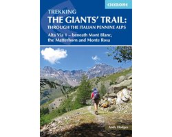
Trekking the Giants' Trail: Alta Via 1 through the Italian Pennine Alps
dans 1 boutique
À voir aussi
Code-barres: 9781783628087

Toutes les offres
- bol.comTrekking the Giants' Trail: Alta Via 1 through the Italian Pennine AlpsVoir la boutique17,99 €En stock
Nous pouvons percevoir une commission si vous achetez via ce lien. Le prix que vous payez ne change pas.
À propos de ce produit
Trek beneath the legendary giants of the Italian Alps along the Giants’ Trail: Alta Via 1, from Donnas to Courmayeur through the breathtaking Aosta Valley. This inspiring 180km (112-mile) route, also known as the Tour of the Giants (Tor des Géants), traces the northern flank of the valley in the shadows of Mont Blanc, the Matterhorn, Monte Rosa, and the Grand Combin. Experience a two-week alpine adventure on quiet trails, far from the crowds, through spectacular mountain scenery, isolated villages, and welcoming refuges. Perfect for trekkers with some alpine experience seeking a rewarding challenge, this authoritative Cicerone guidebook describes the Giant’s Trail in 16 stages, each ranging from 4 to 17km (2–11 miles). It also offers a range of options to tailor your journey, whether you wish to complete the entire trek in one go or split it into two one-week sections, with convenient access at Valtournenche. Alternative variants, including an unforgettable detour to the historic Great St Bernard Monastery, allow you to personalise your trek according to your interests, fitness, and the weather. Marvel at the snow-capped massifs of Mont Blanc, the Matterhorn, Monte Rosa, and the Grand Combin, as each day brings new views and unforgettable moments among the highest mountains in Italy and the Alps. Each stage features clear route descriptions, with distance, ascent/descent, walking time, and detailed information on accommodation, mountain huts, and refreshment options, plus advice on merging shorter stages for longer days or pausing to explore mountain villages like Gressoney and Champoluc, and to sample the region’s rich culture. Includes 1:50,000 mapping for every stage, downloadable GPX tracks, and concise summary tables for itinerary planning, ensuring straightforward…
Description fournie par bol.com.